
Eleven miles on Sunday morning.
How far will you walk tonight?
KevinB
#62

Clcrisler
(Casey Crisler)
#65
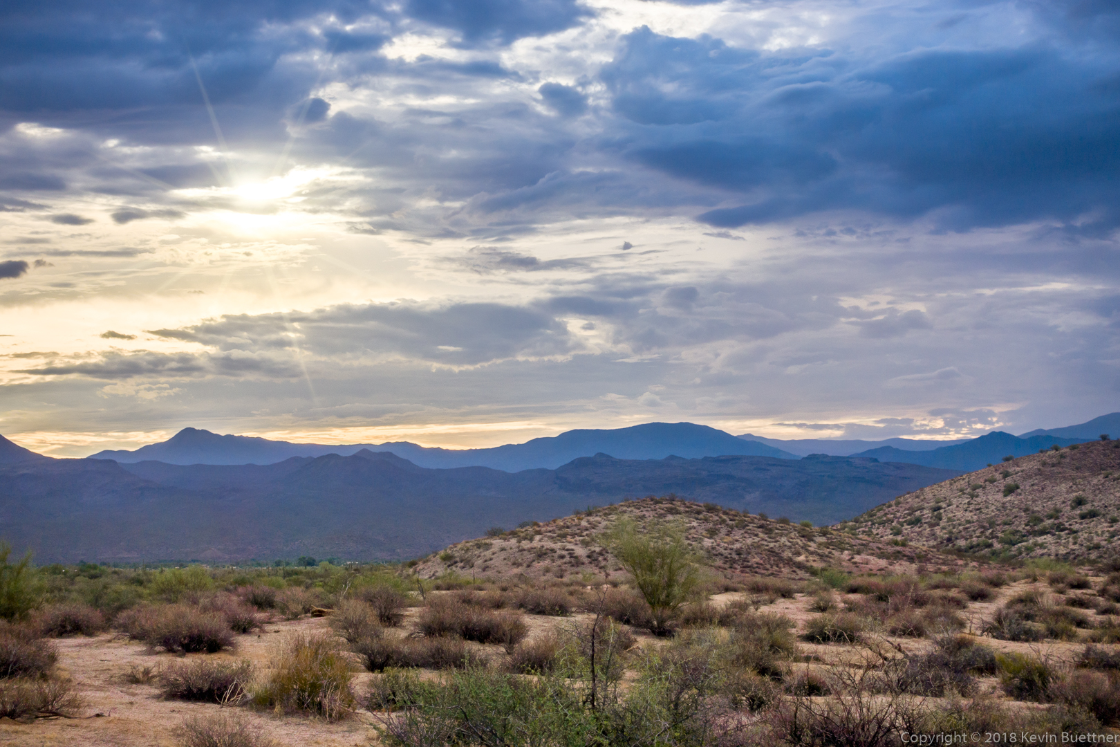
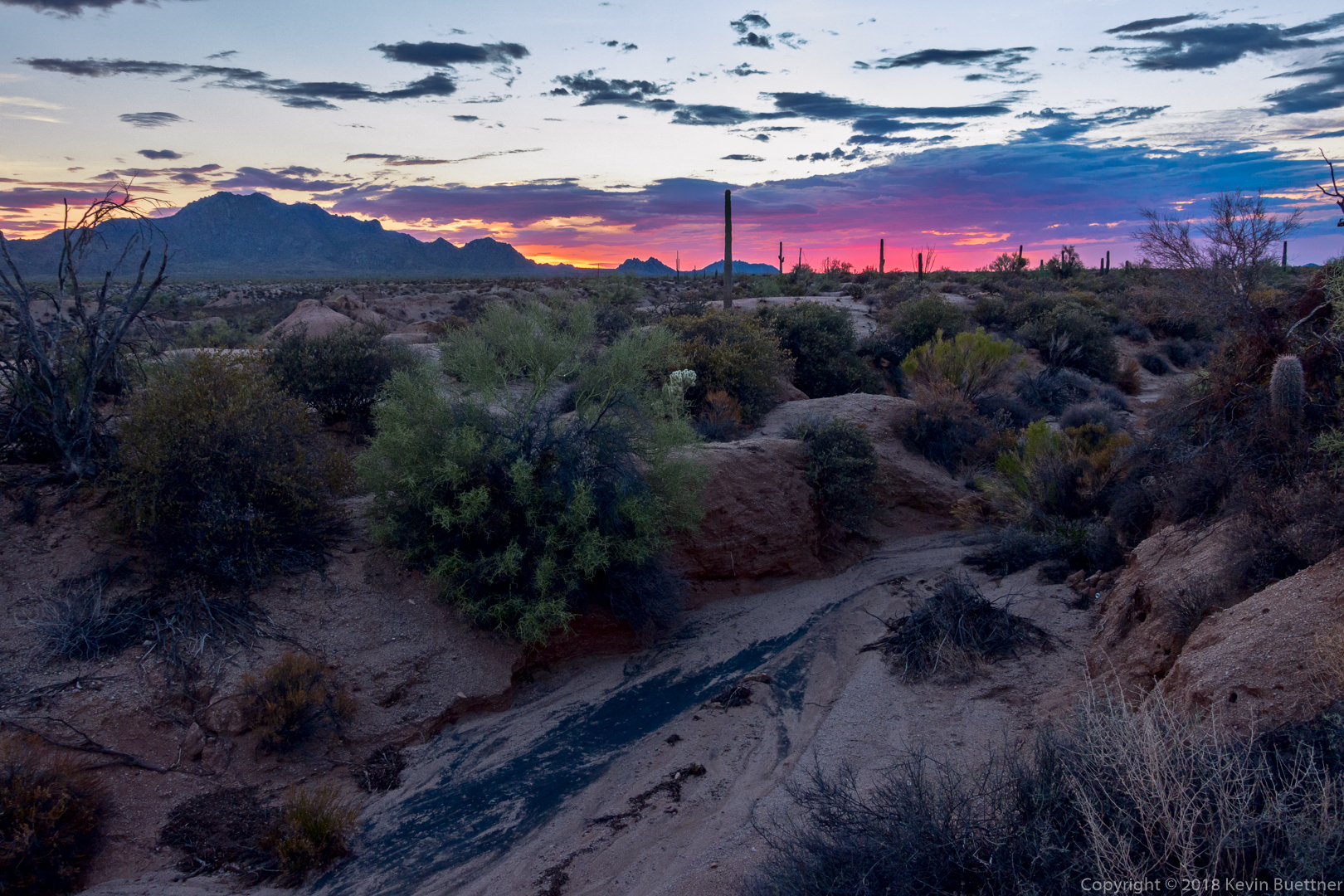
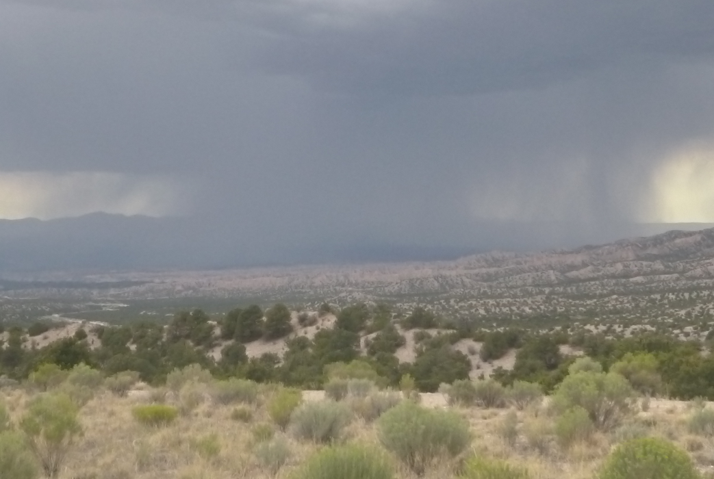
I did two mountains yesterday and this weekend. A couple of pictures from Sunday. Downtown Phoenix in the distance in the first photo.

KevinB
#66
7.4 miles at our local county park on Tuesday night. I heard coyotes as I started out and later saw some rabbits, a lizard, and an owl. The coyotes started howling again after I took the photo below.
KevinB
#67
8.5 miles on Wednesday Night. I varied my loop somewhat from Tuesday’s route. The night was somewhat cooler - starting temp was only 100F, dropping to 97F by the time I finished. (It was 102F on Tuesday.) I saw an owl, but not many other critters on Wednesday night’s hike.
KevinB
#68
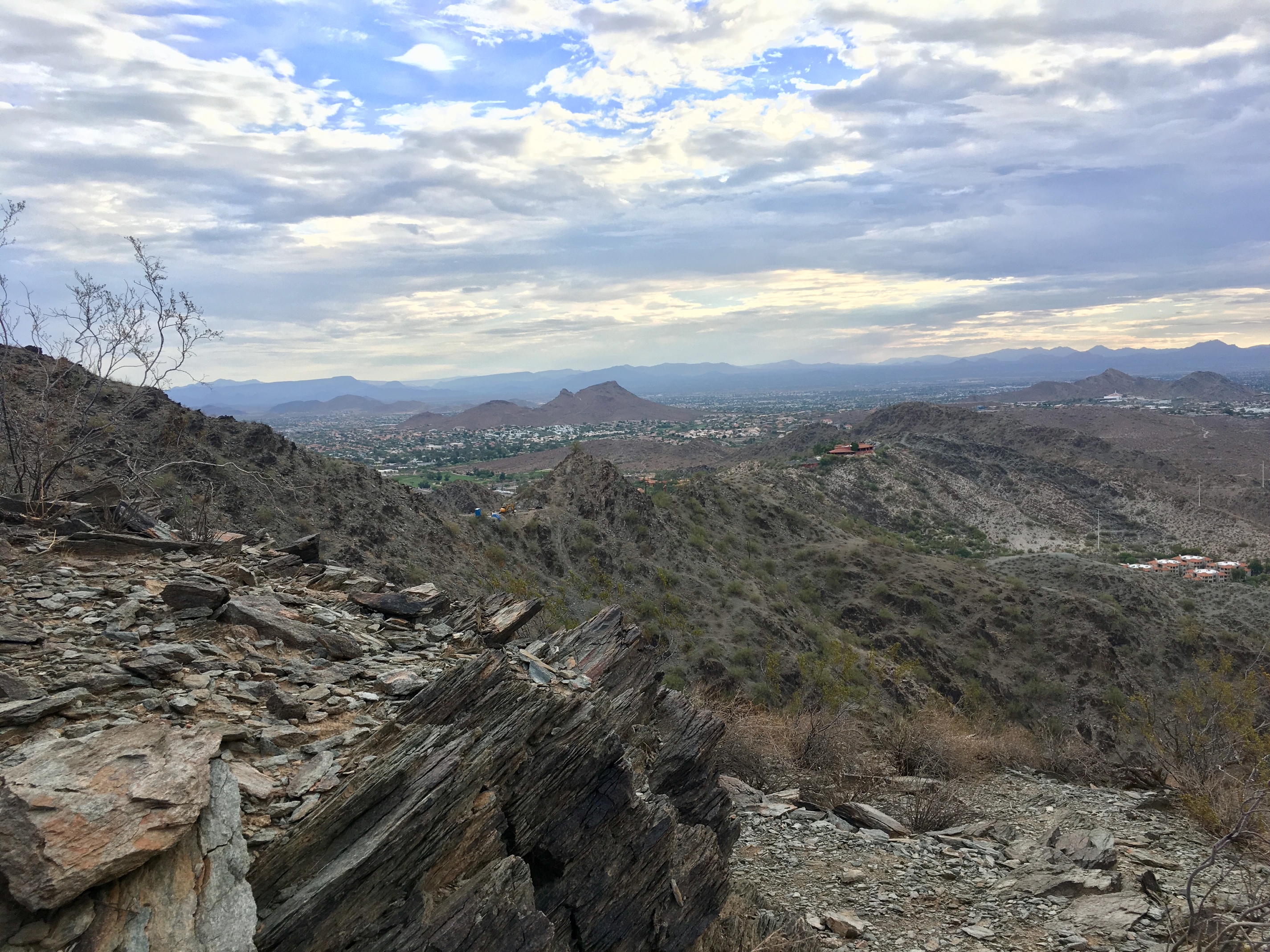
10.3 miles on Friday morning. My friend, Bob, joined me for this one. I hadn’t seen him in a while, so it was good to catch up.
This is a view from (and of) the Pemberton Trail.
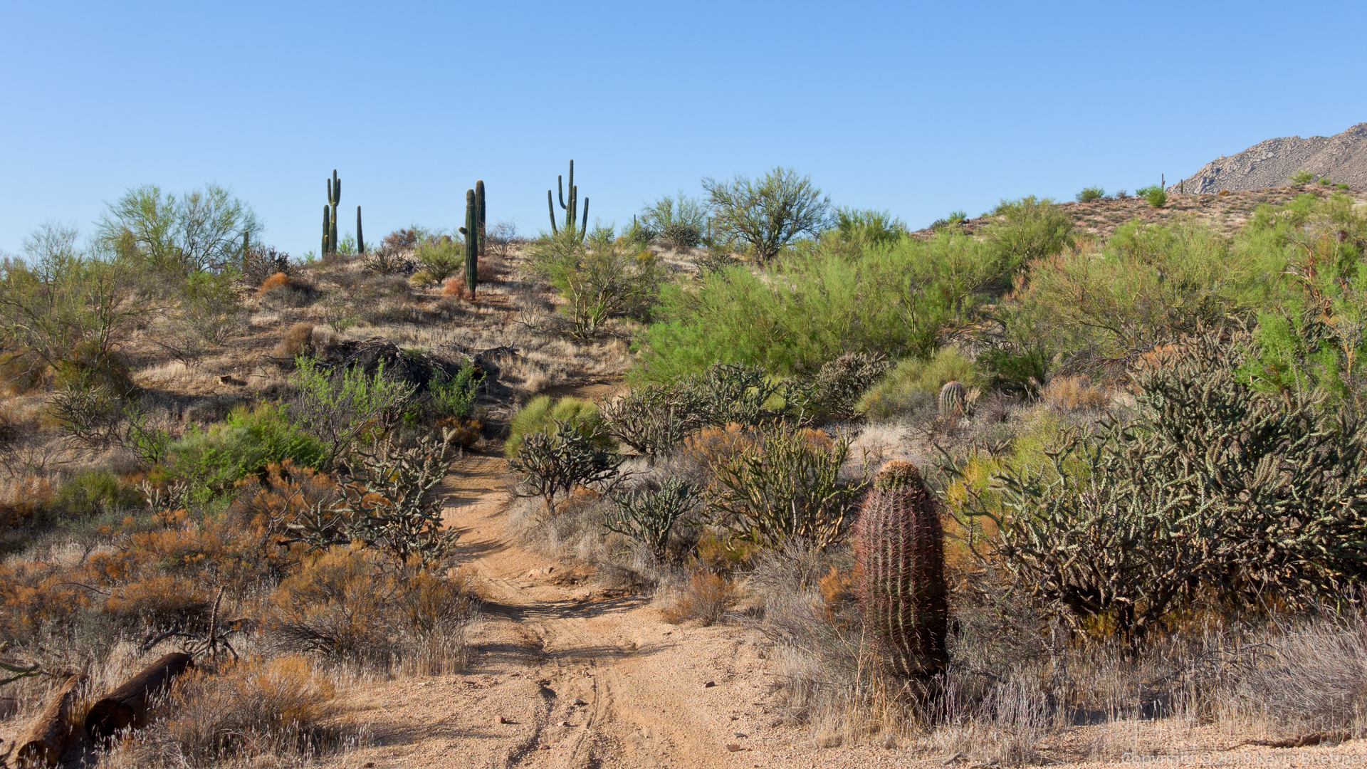
KevinB
#69
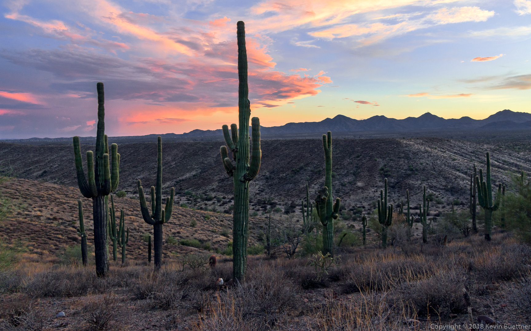
6.4 miles on Monday evening. Temperature was 113 F at the start and 100 F when I finished. The first mile felt oppressively hot, but felt better as I got into some shade.
This is a view of Four Peaks from the Scenic Trail in McDowell Mountain Regional Park.
KevinB
#71
I’ve hiked Tom’s Thumb Trail several (okay, more than just several) times. I posted a photo of Tom’s Thumb earlier in this thread - look for the one where I hiked 11+ miles on July 4.
On that particular day, starting from Tom’s Thumb Trailhead, I hiked a short ways on Tom’s Thumb Trail and then took the first climber’s access trail to the right. This brought me to the ridge on which Tom’s Thumb (the pinnacle) is located. I hiked atop the ridge and then past the Thumb which eventually brought me back to Tom’s Thumb Trail. I then turned right (west) and hiked over to the Scottsdale side of the McDowells. I followed Tom’s Thumb Trail until it intersected with Windgate Trail. I took Windgate back up to Windgate Pass and then down again, passing the intersection with the Bell Pass Trail. A short section of the Windmill Trail brought me over to East End Trail. East End climbed up and up back to Tom’s Thumb Trail. I finished by descending Tom’s Thumb Trail, adding in an extra mile at the end by doing Feldspar, a short segment of Marcus Landslide, and then Caballo.
I used to also hike and climb in the area before the Preserve trails went in. My very first rock climbing experience was a fourth class route (West Corner) on Tom’s Thumb (the pinnacle). Back in 1988, there weren’t any obvious or easy trails leading to Tom’s Thumb. (The trails there now - even the climber’s access trails - are really easy by comparison.) We ended up with lots of scratches on our arms and legs pushing uphill (and later downhill) through brush to get to the place where we could start rock climbing. That was also my second rappelling experience. The first was in Iowa off a railroad bridge, but that’s another story.
I remember another time when my wife and I went searching for the Lost Wall since the guidebook showed some moderate climbs that my wife and I might be able to do. We never did find the Lost Wall, but these days, there’s a nice climber’s access trail which goes there.
Another spot which had always intrigued me was an area known as “Hog Heaven”. It was a pretty remote area and, back then, it might have taken the better part of a day to get there. There is now a loop we do which utilizes yet another climber’s access trail to first go to Hog Heaven and then to the East End peak, which is the highest point in the McDowells. The loop is only about four miles long, but it’s fairly arduous and it often takes the groups I lead about five hours to do it. Here’s a link to some photos from a hike of the Hog Heaven Loop from last January:
https://buettner.to/blog/index.php/2018/01/20/friday-fitness-hike-226/
Clcrisler
(Casey Crisler)
#72
I’m still new to hiking so it’ll be a loooong time before I get to your level, if ever. I just went back up the hill yesterday since I was sidelined after a medical procedure. But once I’m back 100% I will need to up my game a little. Camelback and Squaw Peak are probably the next big hurdles.
cyndimarie
(Cynthia )
#73
I walk for 40 minutes on my lunch hour to stretch my legs out (I’m a court reporter so I sit all day long plus commute 2.5 hrs each day). At night my husband and I do a 30 to 40-minute walk as well.
OldDoug
(Doug)
#74
Roughly 380 miles or 610 km to the east-northeast of the Arizona contingent, my wife and I did about 4 miles around the Sangre de Cristo mountain ski area northeast of Santa Fe, New Mexico. It absolutely kicked our butts. We’re currently lowland flatlanders from Atlanta, and the elevation was ~10,400 feet or 3200 meters. Steep trail; to say we ‘felt it’ is an understatement. 
So we retreated down the mountain and drove around to the western side of the Sangre de Cristos for some amateur storm-chasing.
Looking west to the Jemez mountains - it was just a “stripe” of clouds at first, with the rain not even reaching the ground. After 15 minutes, the rain was hitting the dirt; that’s when the above picture was taken. The rain was advancing east across the valley very slowly. Conditions for storm formation were good - relatively humid air, afternoon heating sending warm air currents aloft. There was a good bit of lightning, but the whole deal didn’t look like all that much yet.
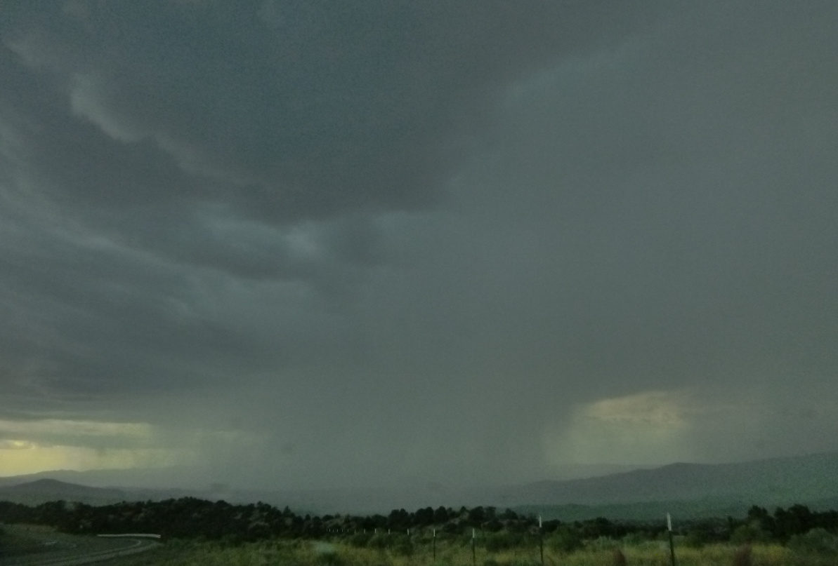
Another half hour and things were getting interesting. Lots of lightning, my wife yelling at me to get the **** back in the car. Developing thunderstorms are fascinating. The air being forced up the slopes of the Sangre de Cristo mountains helped things along, and suddenly it wasn’t just that original cloud - lightning and really dark clouds were all around us. Ended up being a real ‘gully-washer,’ giving parts of Santa Fe over 3 inches of rain.
KevinB
#75
Camelback and Piestewa Peak are both good, though I haven’t done either of them in quite a long time. I did Piestewa Peak back in the late 80s, long before the name change. Even back then, it was kind of a busy hike, which might be why I haven’t been back since.
In addition to hiking to the top of Camelback, my wife and I used to climb at Camelback when we were both starting out. One of our favorite climbs there was the Praying Monk. There’s an easy 5.3 route which goes to the top. It’s pretty exposed though and I remember feeling slightly scared when I did it on lead. The rappel off the Monk has a “free” section where your feet lose contact with the rock and you have to just lower yourself while hanging in the air.
Anyway… I think it’s great that you’re getting out and challenging yourself. When it gets cooler, another one for you to consider is “Peralta to Fremont Saddle”, which is in the Superstitions. Actually, almost everything in the Superstitions is good, but this particular trail is quite popular and easy to follow. When you get to Fremont Saddle, you’ll have an excellent view of Weaver’s Needle. Here’s a link to a description of this hike:
KevinB
#76
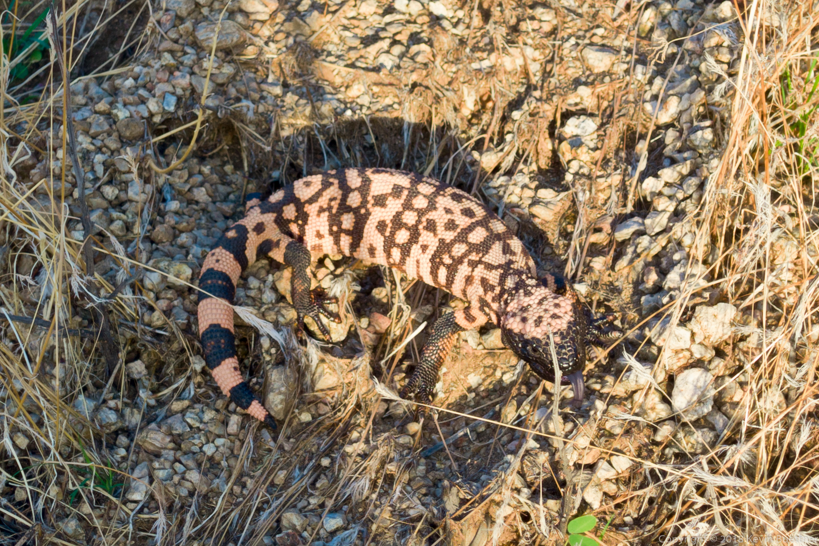
I hiked a little over five miles on Friday Morning - I did the Hog Heaven Loop in the McDowells. I saw this Gila Monster along the way:
SporkyDonkey
#78
Last night I did 4.2 with a 33 lb pack. It was on a fairly level walking path at the local hospital. Got some killer plantar fasciitis in my left foot today.
KevinB
#79
Is this a chronic / recurring problem?
(I’ve had problems with plantar fasciitis in the past too…)
SporkyDonkey
#80
I guess you could call it recurring. I’ve had it two or three other times in the last 15 or so years, but it’s never been this bad or come on so quickly. The other times it started mild and got worse over a few days until I started rolling it out and then it was gone in a few days and stayed gone for years. My foot felt fine when I went to bed, and this morning when I woke up I could barely make it to the bathroom. I’ve been rolling it out with a softball while I’m here at work, and I’ve been making sure to get up and walk around every hour or so.
KevinB
#81
My favorite ball for rolling my feet is the RumbleRoller Beastie…
https://www.amazon.com/RumbleRoller-X-Firm-Beastie-Ball-Troublesome/dp/B00ECASXB2/
(I use these for lower back and other areas too.)
Something else to try is calf massage. Trigger points in the soleus (which is a calf muscle underneath the gastrocnemius) can refer pain to the heel. I find it useful to use a rolling pin type gadget (Tiger Tail, The Stick) to firmly roll the calf. If you find a spot that really hurts, then attempt to release that spot via deeper massage.
I’ve had bouts of PF that didn’t get better with either of those techniques. I’ve had very few problems since switching to minimalist footwear. These shoes have thin flexible soles, allow the toes to spread, and do not significantly elevate the heel. It was this video which led to me switching…
I’ll note, however, that a key to switching to minimialist footwear is to do it slowly. I started out by walking only half a mile on city streets. I found it hard and wasn’t sure I’d be able to stick with it. But I did and, over time, I increased my distance, then started hiking by myself (slowly and gingerly) on rocky hiking trails. After a time, I felt comfortable enough to use minimalist shoes for leading group hikes of 8-12 miles in length.