
10.6 miles on Friday morning…
How far will you walk tonight?
KevinB
#51
Regina
(Empress of the Unexpected)
#54
Do you see a lot of butterflies on your walks? I am involved with butterflies and moths of North America and the local expert says they are not active this year due to the drought. My husband has found none in the Sam Bernardino mountains.
KevinB
#55
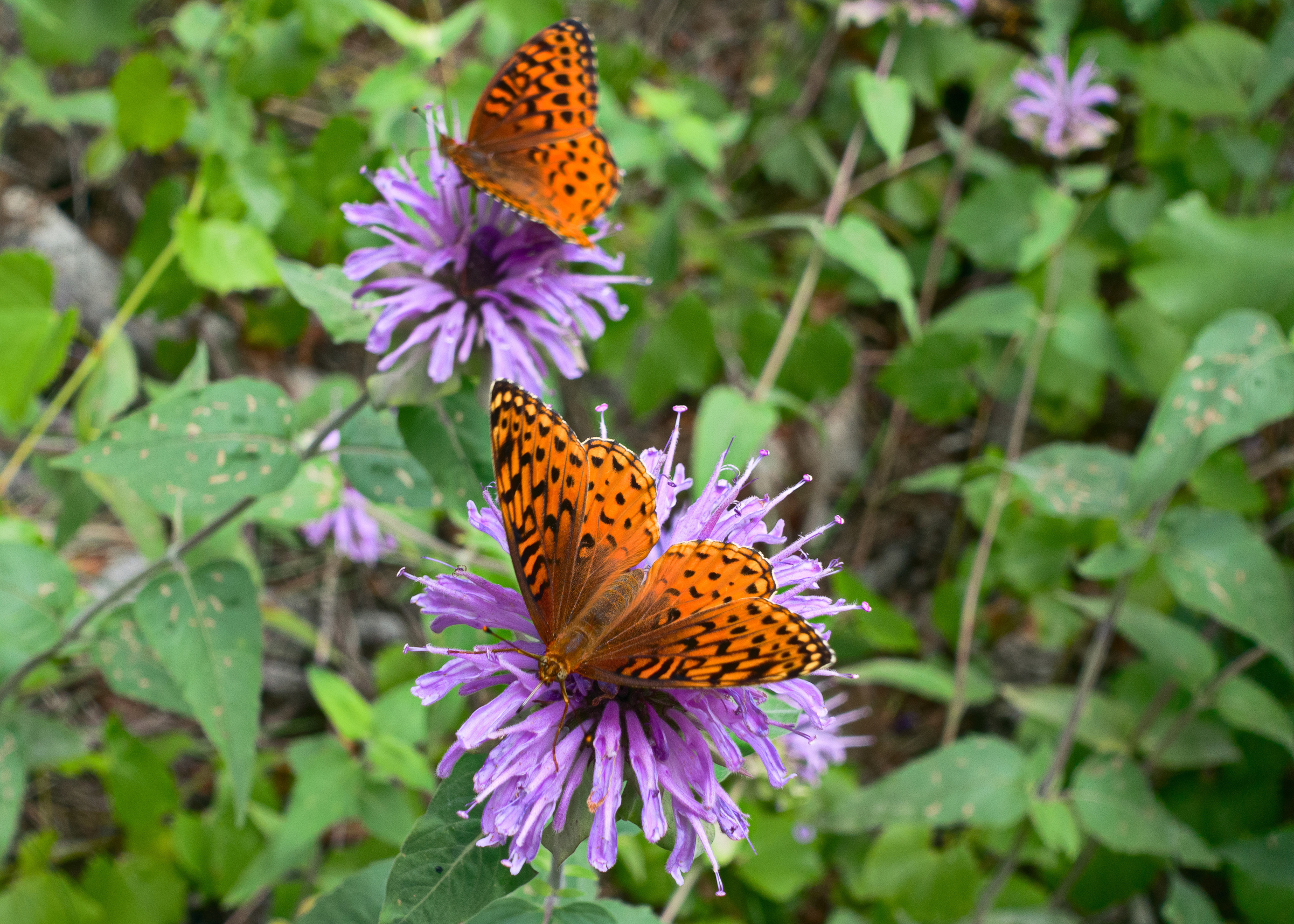
We see some butterflies in the spring, though I don’t recall seeing many this year. I tend to see more butterflies somewhat north of where I do most of my hiking. We saw these butterflies several years ago (in July) while hiking near Horton Springs:
Regina
(Empress of the Unexpected)
#56
So gorgeous. The website is BAMONA (butterflies and moths of North America. Gosh, will id them. Can I steal them for the website?
Regina
(Empress of the Unexpected)
#59
Thanks so much. Your butterflies will become famous. I will send you the link. You said years ago. Does your camera have the date ?
KevinB
#60
July 3, 2015. The date is in both the filename and in the EXIF too.
I sent you a link to another photo privately. (Let’s continue the butterfly discussion in private…)

Clcrisler
(Casey Crisler)
#65
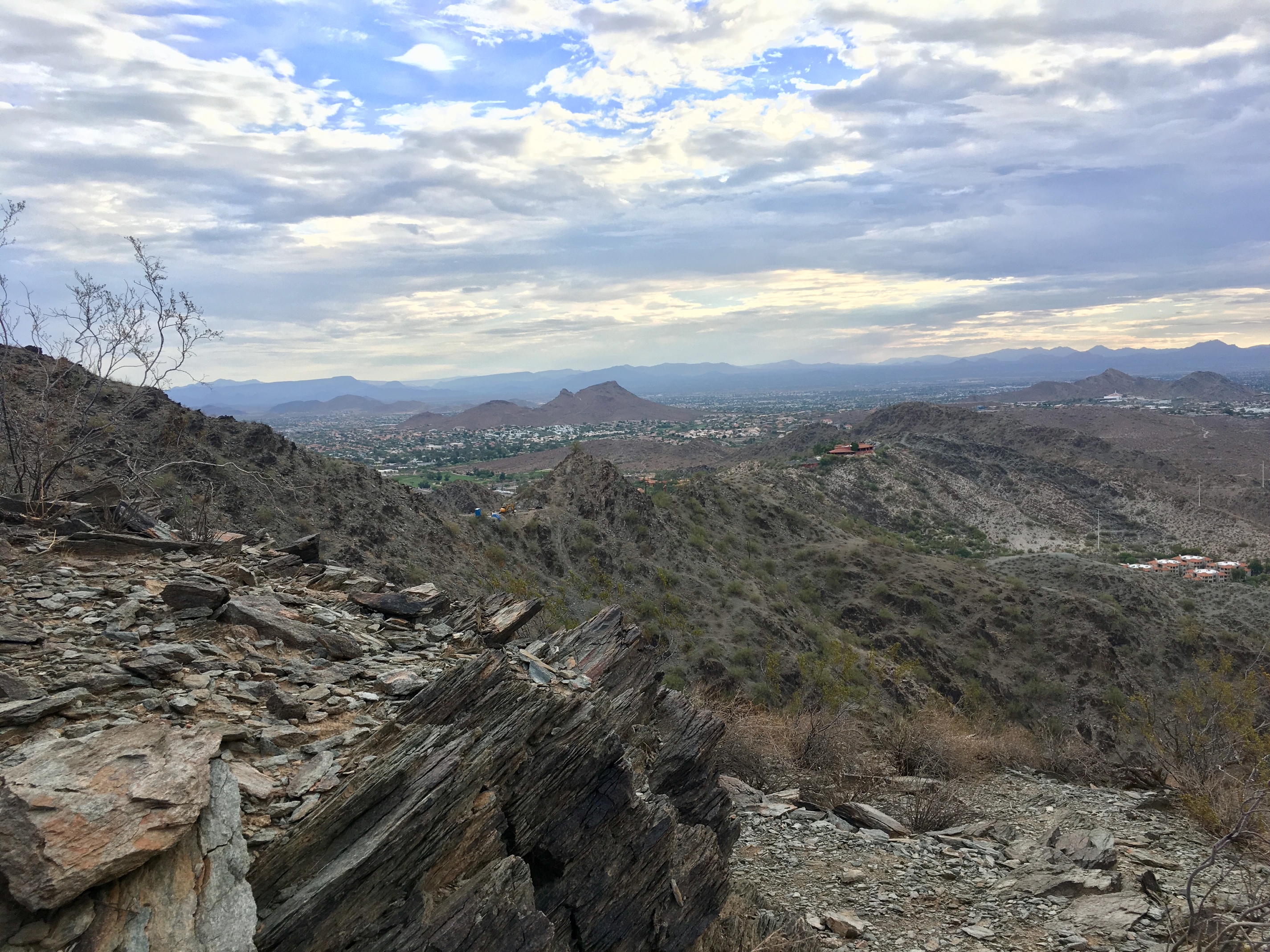
I did two mountains yesterday and this weekend. A couple of pictures from Sunday. Downtown Phoenix in the distance in the first photo.

KevinB
#66
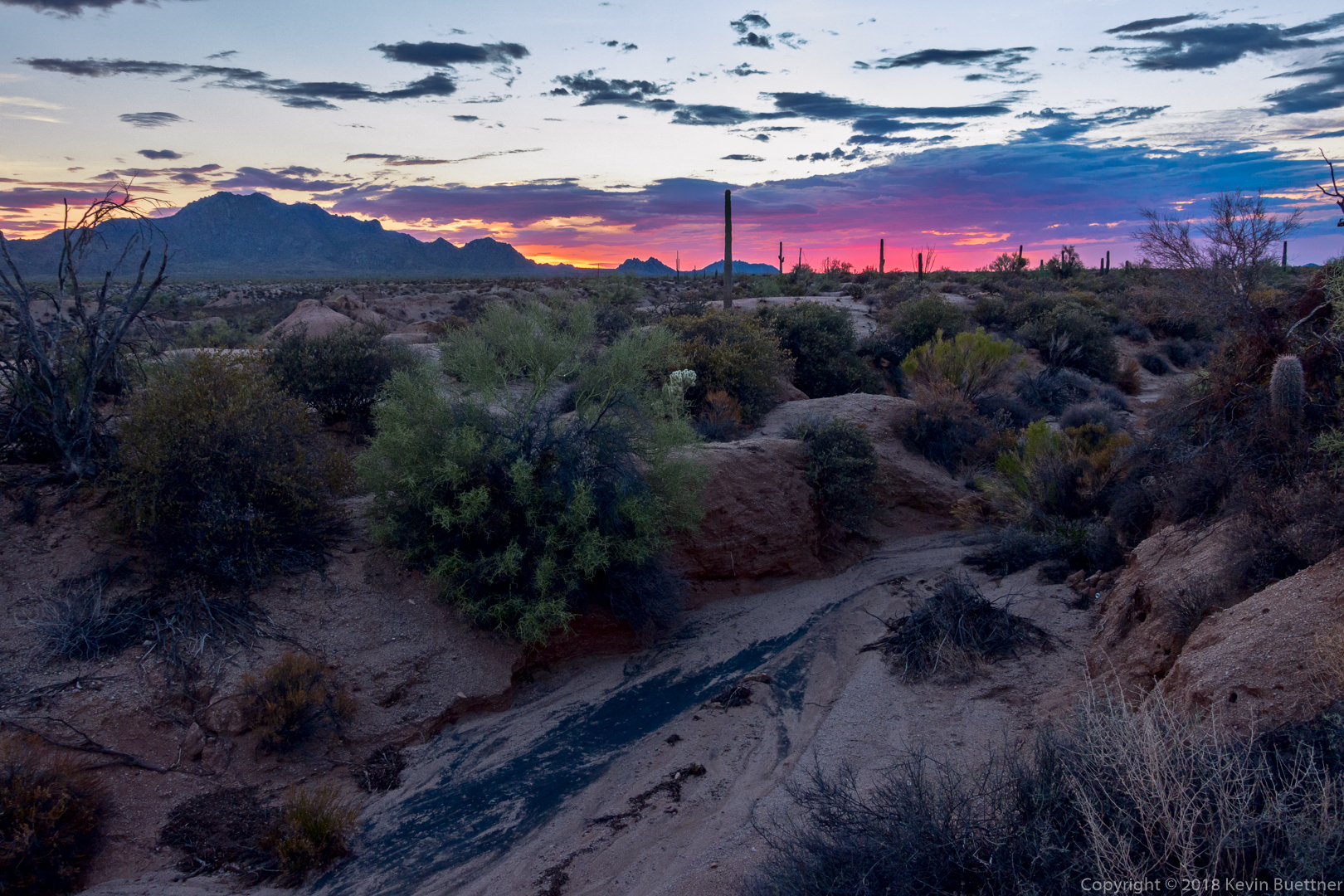
7.4 miles at our local county park on Tuesday night. I heard coyotes as I started out and later saw some rabbits, a lizard, and an owl. The coyotes started howling again after I took the photo below.
KevinB
#67
8.5 miles on Wednesday Night. I varied my loop somewhat from Tuesday’s route. The night was somewhat cooler - starting temp was only 100F, dropping to 97F by the time I finished. (It was 102F on Tuesday.) I saw an owl, but not many other critters on Wednesday night’s hike.
KevinB
#68
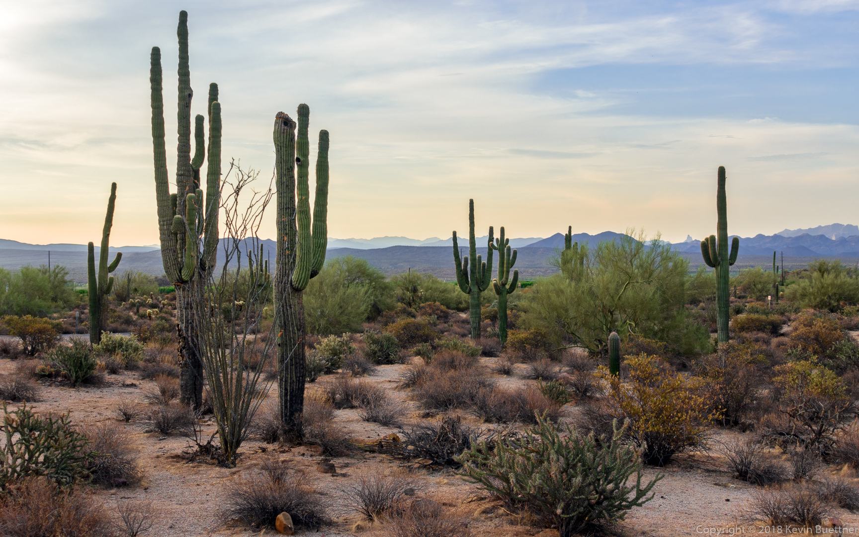
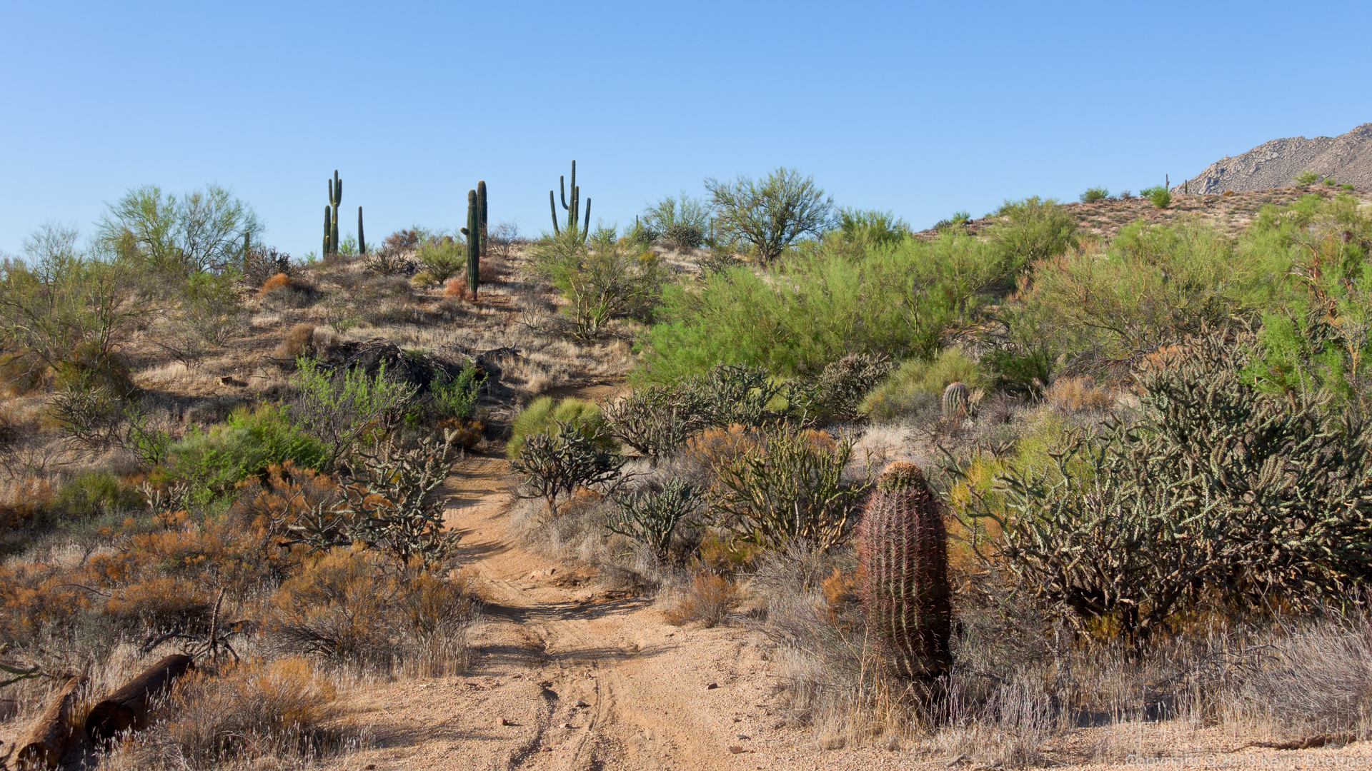
10.3 miles on Friday morning. My friend, Bob, joined me for this one. I hadn’t seen him in a while, so it was good to catch up.
This is a view from (and of) the Pemberton Trail.
KevinB
#69
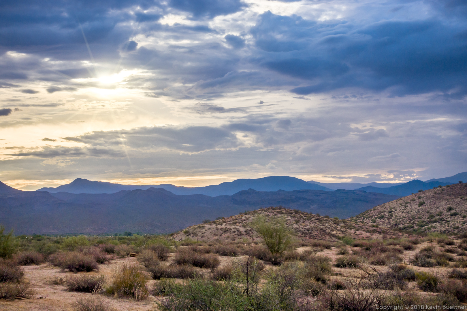
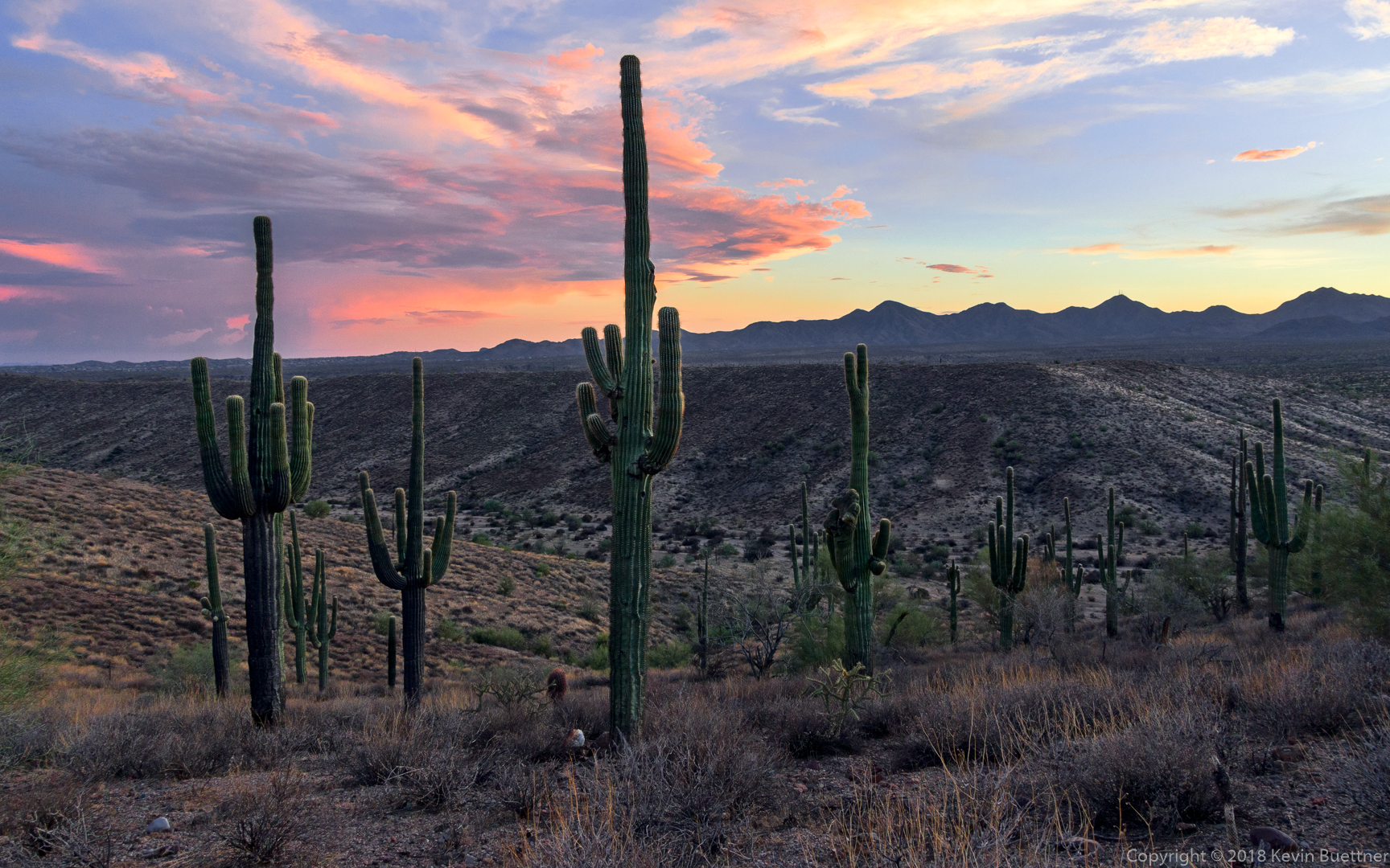
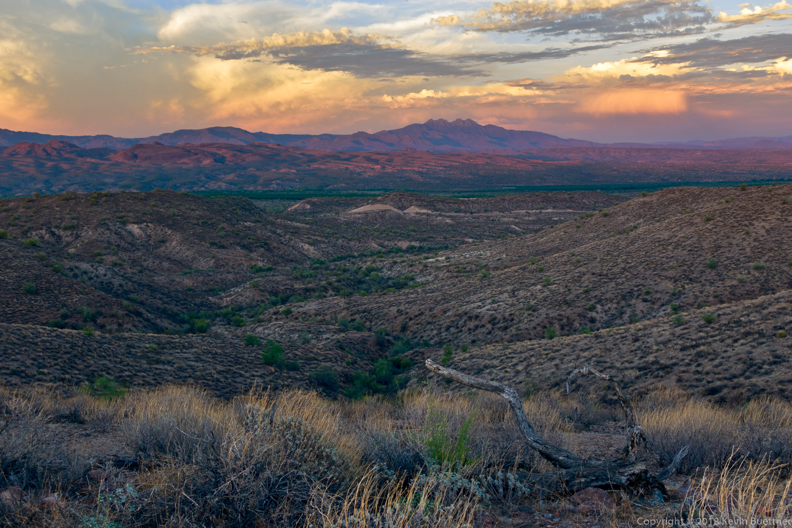
6.4 miles on Monday evening. Temperature was 113 F at the start and 100 F when I finished. The first mile felt oppressively hot, but felt better as I got into some shade.
This is a view of Four Peaks from the Scenic Trail in McDowell Mountain Regional Park.
KevinB
#71
I’ve hiked Tom’s Thumb Trail several (okay, more than just several) times. I posted a photo of Tom’s Thumb earlier in this thread - look for the one where I hiked 11+ miles on July 4.
On that particular day, starting from Tom’s Thumb Trailhead, I hiked a short ways on Tom’s Thumb Trail and then took the first climber’s access trail to the right. This brought me to the ridge on which Tom’s Thumb (the pinnacle) is located. I hiked atop the ridge and then past the Thumb which eventually brought me back to Tom’s Thumb Trail. I then turned right (west) and hiked over to the Scottsdale side of the McDowells. I followed Tom’s Thumb Trail until it intersected with Windgate Trail. I took Windgate back up to Windgate Pass and then down again, passing the intersection with the Bell Pass Trail. A short section of the Windmill Trail brought me over to East End Trail. East End climbed up and up back to Tom’s Thumb Trail. I finished by descending Tom’s Thumb Trail, adding in an extra mile at the end by doing Feldspar, a short segment of Marcus Landslide, and then Caballo.
I used to also hike and climb in the area before the Preserve trails went in. My very first rock climbing experience was a fourth class route (West Corner) on Tom’s Thumb (the pinnacle). Back in 1988, there weren’t any obvious or easy trails leading to Tom’s Thumb. (The trails there now - even the climber’s access trails - are really easy by comparison.) We ended up with lots of scratches on our arms and legs pushing uphill (and later downhill) through brush to get to the place where we could start rock climbing. That was also my second rappelling experience. The first was in Iowa off a railroad bridge, but that’s another story.
I remember another time when my wife and I went searching for the Lost Wall since the guidebook showed some moderate climbs that my wife and I might be able to do. We never did find the Lost Wall, but these days, there’s a nice climber’s access trail which goes there.
Another spot which had always intrigued me was an area known as “Hog Heaven”. It was a pretty remote area and, back then, it might have taken the better part of a day to get there. There is now a loop we do which utilizes yet another climber’s access trail to first go to Hog Heaven and then to the East End peak, which is the highest point in the McDowells. The loop is only about four miles long, but it’s fairly arduous and it often takes the groups I lead about five hours to do it. Here’s a link to some photos from a hike of the Hog Heaven Loop from last January:
https://buettner.to/blog/index.php/2018/01/20/friday-fitness-hike-226/